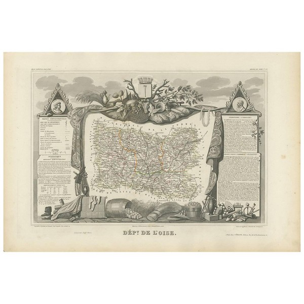
Antique map titled ‘Dépt. de l’Oise’. Map of the French department of Oise, France. The map is surrounded by elaborate decorative engravings designed to illustrate both the natural beauty and trade richness of the land. There is a short textual history of the regions depicted on both the left and right sides of the map. This map originates from ‘Atlas National de la France Illustré’. Published by A. Combette, Paris, 1854.
Take 30% off when you spend $120 Go shop
Free 2-days standard shipping on orders $255+ Custom link
MENU
Menu Categories
- Furniture
- Lighting
- Seating
- Tables
- Mirrors
- Case Pieces and Storage Cabinets
- Wall Decorations
- Serveware
- Decorative Objects
- Building and Garden Elements
- Asian Art and Furniture
- Rugs and Carpets
- More Furniture and Collectibles
- Folk Art
Wishlist 0
Antique Map of Oise ‘France’ by V. Levasseur, 1854
SKU: D-10763901
Categories: Collectibles and Curiosities, Furniture, Maps, More Furniture and Collectibles
Tags: Collectibles and Curiosities, Furniture, Maps, More Furniture and Collectibles Share:
Related products

Italian Gilt Lamp
$1,680.00


